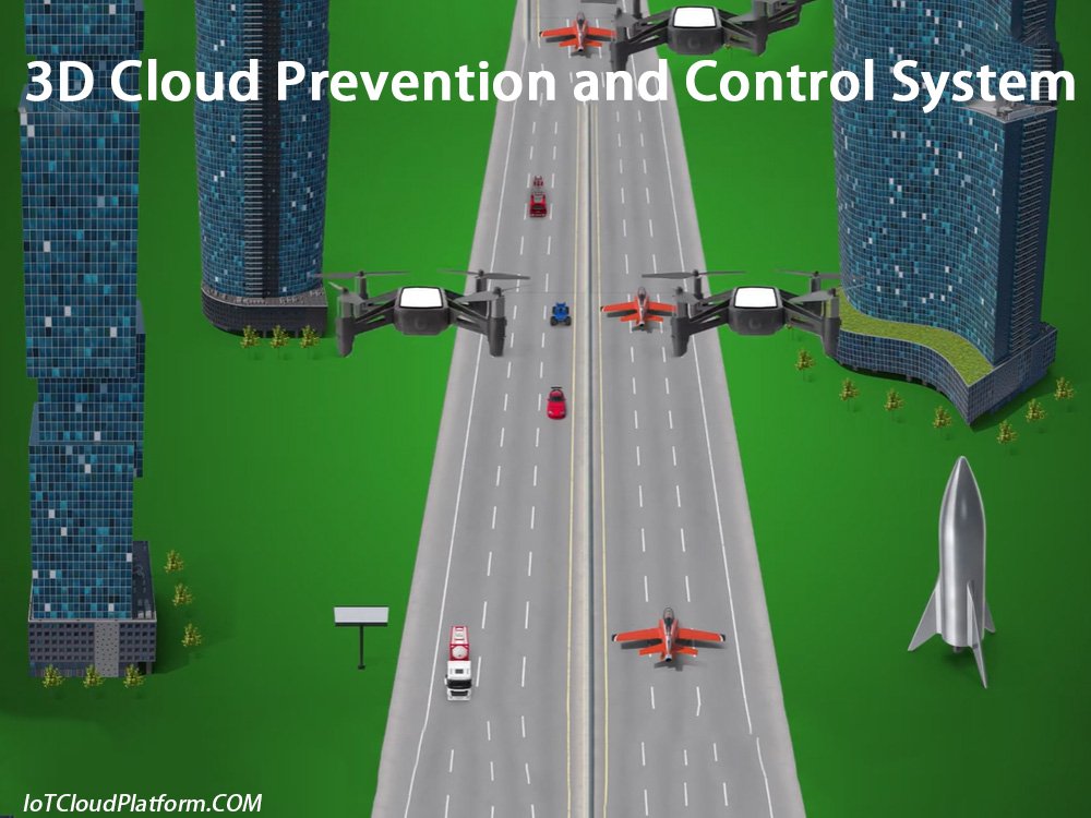
What is the 3D Cloud Prevention and Control System?
The 3D cloud prevention and control system is an advanced security monitoring system that integrates multiple technical means such as augmented reality (AR) technology, video monitoring, and big data analysis, realizing information visualization, video information structuring, and three-dimensional command and dispatch, providing all-round and three-dimensional protection for urban safety.
The following is a detailed introduction to the 3D cloud prevention and control system:
System Overview
The 3D cloud prevention and control system takes AR augmented reality technology as the core. By integrating various monitoring resources and intelligent recognition systems, the roads, buildings, landmarks, key targets, monitoring resources, police resources and other information in the monitoring area are presented in a three-dimensional manner in the monitoring screen.
This presentation method is not only intuitive and easy to understand, but also can greatly improve the monitoring efficiency and the flexibility of command and dispatch.
Scalable 3D Cloud Visualization for Industrial Applications
System Composition
1. Front-end acquisition equipment:
Including high-point cameras, low-point cameras, face recognition equipment, vehicle recognition equipment, etc., which are used to collect video information and recognition information in the monitoring area in real time.
The following is a detailed introduction to the high-point camera, low-point camera, face recognition equipment, and vehicle recognition equipment in the front-end acquisition equipment:
High-point camera
1. Definition and use
High-point cameras are usually installed at higher locations, such as the top of a building, a mountain top, or a high tower, and are used to monitor a larger area. Its wide viewing angle can capture more scene information, and is particularly suitable for monitoring open areas such as city squares, transportation hubs, and large parks.
2. Technical features
- High resolution: High-point cameras usually use high-resolution sensors, which can capture more detailed information and improve the clarity of the monitoring screen.
- Automatic zoom and pan-tilt control: Some high-point cameras are equipped with automatic zoom lenses and pan-tilt control systems, which can be remotely adjusted according to monitoring needs to achieve detailed monitoring of specific areas.
- Night vision function: In order to achieve all-weather monitoring, high-point cameras are usually equipped with infrared night vision function, which can still maintain clear monitoring pictures in low-light environments.
3. Application scenarios
- City monitoring: used to monitor the main roads, squares, parks and other public areas in the city to improve the city’s security management level.
- Park monitoring: In large industrial parks, logistics parks and other places, high-point cameras can achieve comprehensive monitoring of the entire park, and detect and handle abnormal situations in a timely manner.
Low-point camera
1. Definition and use
Low-point cameras are usually installed in lower positions, such as the ground, wall or bracket, and are used to monitor specific areas or details. Its viewing angle is smaller but more focused, and it can capture more detailed information. It is particularly suitable for indoor monitoring, community entrances, parking lots and other places.
2. Technical features
- Fixed focal length and wide-angle lens: Low-point cameras usually use fixed focal length lenses or wide-angle lenses to meet the needs of different monitoring scenarios. Fixed focal length lenses are suitable for detailed monitoring of specific areas, while wide-angle lenses can capture wider scene information.
- Intelligent recognition function: Some low-point cameras are equipped with intelligent recognition functions, such as face recognition, license plate recognition, etc., which can realize automatic recognition and tracking of specific targets.
- Waterproof and dustproof design: In order to adapt to the use requirements of outdoor environments, low-point cameras usually adopt waterproof and dustproof design, which can maintain normal operation under adverse weather conditions.
3. Application scenarios
- Indoor monitoring: In indoor places such as shopping malls, offices, and schools, low-point cameras can monitor detailed information such as personnel activities and item placement.
- Community entrance and parking lot monitoring: At places such as community entrances and parking lots, low-point cameras can monitor the entry and exit of vehicles and personnel, and improve the safety management level of the community.
Face recognition equipment
1. Definition and use
Face recognition equipment is a monitoring device based on biometric recognition technology. It realizes the identity recognition and verification of specific personnel by collecting and analyzing facial image information. It is widely used in access control systems, attendance systems, payment verification and other fields.
2. Technical features
- High-precision recognition: Face recognition equipment uses advanced image processing and recognition algorithms to achieve high-precision recognition and matching of facial features. Even in complex lighting environments, expression changes and interference from obstructions, it can maintain a high recognition accuracy rate.
- Non-contact recognition: Face recognition equipment uses non-contact recognition, and users can complete identity recognition and verification without direct contact with the device. This not only improves the convenience of recognition, but also avoids the hygiene problems that may be caused by contact recognition.
- Live detection technology: In order to prevent fraudulent behavior such as photos and videos that forge facial information, face recognition equipment usually uses live detection technology. This technology collects and analyzes the biometric information of the face (such as blinking, opening the mouth, etc.) to determine whether the face is real and alive.
3. Application scenarios
- Access control system: In important places such as prisons, detention centers, party and government agencies, and bank business halls, the face recognition access control system can realize the identity recognition and verification of people entering and leaving, and improve the safety management level of the place.
- Attendance system: In enterprises, schools and other places, the facial recognition attendance system can realize the attendance management of employees and improve the accuracy and convenience of attendance.
Vehicle Identification Equipment
1. Definition and Use
Vehicle identification equipment is a monitoring device based on image processing and recognition technology. It can identify and verify the identity, type, color and other characteristics of the vehicle by collecting and analyzing vehicle image information. It is widely used in parking lot management, traffic violation monitoring and other fields.
2. Technical Features
- License Plate Recognition Technology: Vehicle identification equipment usually adopts license plate recognition technology, which can realize the rapid identification and matching of license plate number, license plate color and other information. Even in complex lighting environments, license plate damage or occlusion, it can maintain a high recognition accuracy.
- Vehicle Model Identification Function: Some vehicle identification equipment also has vehicle model identification function, which can identify and classify vehicle types by analyzing and comparing vehicle appearance features.
- Real-time Data Processing and Transmission: Vehicle identification equipment can collect and process vehicle image information in real time, and transmit the identification results to the background management system in real time. This helps to realize real-time monitoring and management of vehicle entry and exit, violations, etc.
3. Application scenarios
- Parking lot management: In smart parking lots, vehicle identification equipment can realize automatic identification, billing and management of vehicles entering and leaving, improving the intelligence level and user experience of parking lots.
- Traffic violation monitoring: In traffic arteries or areas with high incidence of violations, vehicle identification equipment can realize automatic identification and recording of illegal vehicles, providing a strong basis for law enforcement for traffic management departments.
High-point cameras, low-point cameras, face recognition equipment and vehicle identification equipment have their own characteristics and play an important role in the field of security IoT monitoring. Their application scenarios are wide and diverse, and can meet the needs of different industries and fields for monitoring equipment.
2. Backend processing platform:
Including video processing servers, big data analysis platforms, AR information overlay systems, etc., for structured processing, intelligent analysis and AR information overlay of collected video information.
The following is a detailed introduction to video processing servers, big data analysis platforms, and AR information overlay systems:
Video processing server
1. Definition and function
A video processing server is a device or software system specifically used to store, manage and transmit video content. It can efficiently process large amounts of video data, support multi-user simultaneous access and streaming, and is widely used in the media industry, security monitoring, online education and other fields. The main functions include video storage, video encoding and transcoding, video on demand (VOD), live broadcast services, user management and permission control, and data statistics and analysis.
2. Technical features
- Large-capacity storage: The video processing server supports large-capacity hard disks or disk arrays to ensure the safe storage of video files.
- Efficient encoding and transcoding: It can encode and transcode videos in different formats to adapt to different playback requirements and network environments.
- Multi-user concurrent access: It supports multi-user simultaneous access and streaming to ensure the smoothness of the user’s viewing experience.
- Intelligent management: It provides user management and permission control functions. Administrators can assign different access rights to different users to ensure the security of the content. At the same time, it can also record users’ viewing behavior and generate detailed statistical reports to help operators understand user needs.
3. Application scenarios
- Media and entertainment industry: Provide on-demand services for video content such as movies, TV series, and variety shows.
- Education: Supports recording, storage and distribution of online course videos, making it convenient for students to learn anytime and anywhere.
- Internal corporate training: used to save and manage employee training materials and improve training efficiency.
- Security monitoring: As part of the monitoring system, it stores and manages surveillance videos for easy review and analysis afterwards.
- Live streaming platform: Provides stable live streaming services for anchors to ensure that viewers can watch live content smoothly.
Big data analysis platform
1. Definition and function
Big data analysis platform refers to an integrated system that can process, store and analyze massive data. Its core functions include data acquisition, data storage, data processing, data analysis and data visualization. These platforms usually have high-performance computing capabilities, distributed storage and processing architecture, can support the integration of multiple data sources, and provide rich analysis tools and visualization functions.
2. Technical features
- High-performance computing capabilities: Big data analysis platforms have powerful computing capabilities and can process massive data to meet the needs of real-time analysis and complex queries.
- Distributed storage architecture: Distributed storage architecture is adopted to meet the storage needs of massive data. Common storage technologies include Hadoop Distributed File System (HDFS), NoSQL databases (such as Cassandra, MongoDB) and cloud storage services. These technologies can provide high availability and scalability, ensuring data reliability and security.
- Diverse data source support: Big data analysis platforms can support a variety of data sources, including structured data, semi-structured data and unstructured data. This helps enterprises obtain data from multiple perspectives and conduct comprehensive analysis.
- Rich analysis tools: Provides a wealth of data analysis tools and algorithms, including statistical analysis, data mining and machine learning. These tools can help users explore potential patterns and associations in data and reveal potential laws and trends in data.
- Intuitive visual interface: Big data analysis platforms usually have intuitive visual interfaces, which can intuitively display complex data analysis results to users in the form of charts, dashboards and interactive interfaces. This helps users quickly understand the distribution, trends and anomalies of data, so as to make more informed decisions.
3. Application scenarios
Big data analysis platforms are widely used in many fields, including but not limited to finance, medical care, retail, manufacturing and government. In the financial field, big data analysis platforms can be used for risk management, fraud detection and investment decisions; in the medical field, they can be used for disease prediction, personalized treatment and public health monitoring; in the retail field, they can be used for customer segmentation, inventory management and marketing; in the manufacturing field, they can be used for production optimization, quality control and supply chain management; in the government field, they can be used for social governance, public safety and policy making.

Cyber Security – IoT Security – 3D Cloud Security Systems
AR Information Overlay System
1. Definition and Function
AR (Augmented Reality) information overlay system is a technology that overlays computer-generated virtual information such as images, sounds, and videos onto the real-world environment. It can enhance the user’s perception and experience and provide users with a richer and more intuitive way of displaying information.
2. Technical Features
- Real-time interactivity: The AR information overlay system can capture the interaction information between the user and the real world in real time, and generate and update virtual information in real time according to user needs.
- High-precision positioning: By utilizing sensor fusion, image registration and other technologies, the AR information overlay system can achieve high-precision positioning to ensure accurate alignment of virtual information with the real world.
- Diverse information display: AR information overlay system can support virtual information display in various forms such as text, pictures, videos, audio, etc., to meet users’ diverse information needs.
- Cross-platform compatibility: AR information overlay system usually has good cross-platform compatibility and can run on multiple devices such as smartphones, tablets, AR glasses, etc.
3. Application scenarios
- Game field: Through the AR information overlay system, players can interact with virtual characters in a real environment to enhance the immersion and fun of the game.
- Education field: Teachers can use the AR information overlay system to overlay virtual models on real objects for teaching and learning, helping students better understand abstract concepts.
- Retail field: Merchants can provide consumers with virtual try-on, trial and other services through the AR information overlay system to enhance consumers’ shopping experience.
- Medical field: Doctors can use the AR information overlay system for surgical assistance and medical image enhancement to improve the accuracy and safety of surgery.
- Navigation field: Through the AR information overlay system, users can see virtual navigation information in a real environment to improve the intuitiveness and accuracy of navigation.
In summary, the video processing server, big data analysis platform, and AR information overlay system each have unique functions and technical characteristics, and play an important role in their respective application fields.
3. Command and dispatch system:
Including three-dimensional command map, police force deployment system, emergency response system, etc., which are used to realize the three-dimensional and efficient command and dispatch.
The following is a detailed introduction to the three-dimensional command map, police force deployment system, and emergency response system:
Three-dimensional command map
1. Definition and function
Three-dimensional command map is a map combat application with command business as the core. It uses electronic sand table, resource query, decision analysis and other tools to provide a visual environment for command and generate combat maps for combat. The three-dimensional command map can not only display police situation and police resources on the map, but more importantly, it can build a complete process of police command behavior on the map.
2. Technical features
- Three-dimensional visualization: The three-dimensional command map uses three-dimensional visualization technology to intuitively display geographical environment information such as terrain, buildings, roads, and police force distribution, police situation dynamics and other police information.
- Integrated system: The three-dimensional command map is an integrated system, which consists of GIS/BIM/CIM/charts/spatial-temporal databases as the basic information layer, perception systems/intelligence/alarm reception as the external systems as the police situation layer, knowledge bases/maps/risk assessment models as the police knowledge layer, PGIS map analysis/electronic sandbox/decision tree tools as the command analysis layer, and police APP/operation maps/supervision/performance management as the police task release and tracking.
- Real-time update: The three-dimensional command map can update the police situation and police resource information in real time to ensure that the commander can obtain the latest situation.
3. Application scenarios
The three-dimensional command map is widely used in command and dispatch in the fields of public security, fire protection, emergency management, etc. It can help commanders quickly understand the on-site situation, formulate reasonable combat plans, and improve the efficiency and accuracy of command and dispatch.
Police force deployment system
1. Definition and function
The police force deployment system is a software system used to plan and deploy police force. It can automatically or manually generate the optimal police force deployment plan based on multiple factors such as police situation, geographical environment, and police resources.
2. Technical features
- Intelligent planning: The police force deployment system can use advanced algorithms and technologies to automatically generate the optimal police force deployment plan based on the input police situation information and geographical environment information.
- Visual display: The system can provide a visual police force deployment interface, so that commanders can intuitively understand the distribution and configuration of police force.
- Flexible adjustment: The police force deployment system allows commanders to flexibly adjust the deployment plan according to actual conditions to meet the needs of different scenarios.
3. Application scenarios
The police force deployment system is widely used in police force planning and deployment in the fields of public security, traffic police, and firefighting. It can help commanders quickly formulate reasonable police force deployment plans and improve the utilization efficiency and response speed of police force.
4. Examples
The drone three-dimensional police force deployment system is an advanced police force deployment system. It uses drone aerial photography technology to obtain three-dimensional terrain information on the scene, and combines the GIS platform to achieve overall and local three-dimensional visualization. The system can quickly import deployment plans, carry out police force deployment, and has functions such as data application, drone 3D modeling, and 2D orthographic image production. In special combat applications such as counter-terrorism special operations, the system can help on-site commanders make timely and accurate decisions.
Emergency Response System
1. Definition and Function
The emergency response system is a comprehensive system that integrates early warning, command, dispatch, rescue and evaluation. It aims to respond to emergencies quickly and effectively, and protect people’s lives and property and social stability.
2. Technical Features
- Quick Perception and Response: The emergency response system can use modern communication technology to quickly perceive the occurrence of emergencies, and quickly initiate emergency plans to respond.
- Data Integration and Analysis: The system can integrate various information resources, and use powerful data analysis and processing capabilities to deeply mine and analyze various information, providing scientific basis for decision makers.
- Cooperative Operation Capability: The emergency response system focuses on interconnection and resource sharing with other related systems, forming a strong collaborative operation capability.
3. Application Scenarios
The emergency response system is widely used in the response to emergencies such as natural disasters, accidents and disasters, public health incidents and social security incidents. It can help relevant departments and personnel quickly and accurately understand the situation of the incident, formulate reasonable rescue plans, and coordinate the forces of all parties for rescue and disposal.
In summary, the three-dimensional command map, police force deployment system and emergency response system are all important command and dispatch tools, and they play an important role in their respective fields. The application of these systems will help improve the efficiency and accuracy of command and dispatch, and protect the safety of people’s lives and property and social stability.
IoT Security Monitoring System – 3D Cloud Prevention and Control Systems
System Function
1. Information Visualization:
The 3D Stereoscopic Cloud Prevention and Control System can present various types of information in the monitoring area in a three-dimensional manner in the monitoring screen, including roads, buildings, landmarks, key targets, etc. This presentation method enables monitoring personnel to intuitively understand the overall situation in the monitoring area and improve monitoring efficiency.
2. Video Information Structuring:
The system can perform structured processing on the collected video information, extract the characteristic information of pedestrians and vehicles, and background label information, etc. This information provides an important data source for subsequent big data analysis.
3. Three-dimensional Command and Dispatch:
The system supports the realization of command and dispatch functions such as police force deployment and emergency response on a three-dimensional command map. By calling the video information of the high-point camera and the low-point camera, the monitoring personnel can understand the overall situation and detailed information in the monitoring area in real time, so as to achieve fast and accurate command and dispatch.
4. Multi-level label support:
The system supports labeling of various types of information in the monitoring area, including static labels, dynamic labels, etc. These labels can be associated with different data and information, which is convenient for monitoring personnel to retrieve and analyze.
5. Real-time image on-demand function:
The system can perform real-time on-demand image according to the specified device and specified channel, and supports the display, zoom, capture and recording of on-demand images. This helps monitoring personnel to understand the dynamic situation in the monitoring area in real time.
6. Streaming media distribution:
The system can support media access requests and distribute streaming media data to the requesting party. This helps to achieve the sharing and collaborative work of monitoring information.
7. Intelligent recognition and alarm:
The system integrates intelligent recognition technologies such as face recognition and vehicle recognition, and can perform real-time recognition and comparison of pedestrians and vehicles in the monitoring area. When a blacklisted person or vehicle is found, the system will automatically alarm and present relevant information, which is convenient for monitoring personnel to respond and handle quickly.
8. Resource integration and fusion:
The system can connect with the existing subsystems of the public security to extract valuable operation data, alarm information, control information and other resources for on-site command and dispatch. This information is comprehensively displayed on the cloud defense system command and dispatch console in the form of augmented reality dynamic tags and floating animations, which greatly improves work efficiency.
System application
3D stereoscopic cloud prevention and control system is widely used in important security industry fields such as city squares, transportation hubs, government enterprises, comprehensive business districts, anti-terrorism and stability maintenance. The following are several specific application scenarios:
1. City square monitoring:
In crowded places such as city squares, the system can realize real-time monitoring and intelligent identification of pedestrians and vehicles. When abnormal behavior or suspicious persons are found, the system will automatically alarm and present relevant information, which is convenient for monitoring personnel to respond and handle quickly.
2. Transportation hub monitoring:
In transportation hubs such as airports and railway stations, the system can realize real-time monitoring and intelligent dispatch of pedestrian and vehicle flows. By calling the video information of high-point cameras and low-point cameras, monitoring personnel can understand the overall situation and detailed information of the transportation hub in real time, so as to achieve fast and accurate command and dispatch.
3. Government and enterprise security:
In places such as government enterprises, the system can realize real-time monitoring and protection of important areas and sensitive information. Through intelligent identification and alarm functions, the system can timely discover and deal with potential safety hazards to ensure the safety and stability of government enterprises.
4. Comprehensive business district monitoring:
In commercial places such as comprehensive business districts, the system can realize real-time monitoring and intelligent analysis of human and logistics flows. Through big data analysis technology, the system can dig out consumer behavior patterns and consumption habits, and provide merchants with targeted marketing strategies and service optimization suggestions.
5. Anti-terrorism and stability maintenance monitoring:
In security fields such as anti-terrorism and stability maintenance, the system can realize real-time monitoring and intelligent early warning of key areas and sensitive targets. Through intelligent identification and alarm functions, the system can timely discover and deal with potential terrorist attacks and violent incidents to ensure social safety and stability.
System advantages
- Intuitive and easy to understand: The 3D cloud prevention and control system presents monitoring information in a three-dimensional way, allowing monitoring personnel to intuitively understand the overall situation and detailed information in the monitoring area. This greatly improves monitoring efficiency and the flexibility of command and dispatch.
- Efficient and intelligent: The system integrates a variety of technical means such as intelligent identification and big data analysis, which can realize rapid processing and intelligent analysis of monitoring information. This helps monitoring personnel to promptly discover and deal with potential safety hazards and abnormal situations.
- Resource integration: The system can connect with the existing subsystems of the public security to extract valuable operating data, alarm information, control information and other resources. These resources are comprehensively displayed on the cloud defense system command and dispatch console in the form of augmented reality dynamic tags and floating animations, greatly improving work efficiency.
- Strong scalability: The 3D cloud prevention and control system has good scalability and can be customized and secondary developed according to actual needs. This helps to meet the personalized needs of different industries and fields for security monitoring systems.
System implementation and cases
The implementation of the 3D cloud prevention and control system includes multiple links such as demand analysis, system design, equipment selection, installation and debugging. During the implementation process, it is necessary to fully consider the characteristics and needs of the monitoring area, as well as factors such as the scalability and compatibility of the system. The following are some successful cases:
- A prefecture-level city public security project in Guangxi, China: This project uses a 3D cloud prevention and control system to achieve real-time monitoring and intelligent dispatch of important areas such as city squares and transportation hubs. Through the efficient operation and intelligent analysis functions of the system, the public security department has successfully cracked many criminal and public security cases, effectively maintaining social security and stability.
- A prefecture-level city smart security project in Hunan, China: This project uses a 3D cloud prevention and control system as the core component of smart security. Through the real-time monitoring and intelligent identification functions of the system, comprehensive protection of important areas such as government enterprises and comprehensive business districts is achieved. At the same time, the system also provides rich data analysis and visualization display functions, providing strong support for the decision-making of government departments.
- A university security upgrade project in Jiangxi, China: This project uses a 3D cloud prevention and control system to comprehensively upgrade the security system of the university. Through the intelligent identification and alarm functions of the system, real-time monitoring and protection of key areas and sensitive targets on campus are achieved. At the same time, the system also provides convenient image on demand and streaming media distribution functions, making it convenient for people inside and outside the school to understand the dynamic situation on campus in real time.
System Outlook and Development Trends
With the continuous advancement of technology and the continuous expansion of application scenarios, the 3D cloud prevention and control system will usher in a broader development prospect. In the future, the system will continue to optimize and innovate in the following aspects:
- Technology Integration and Innovation: Deeply integrate and innovate AR technology with new technologies such as the Internet of Things and artificial intelligence to further improve the intelligence level and application effect of the system. For example, by introducing the Internet of Things technology to achieve interconnection and data sharing between devices; by introducing artificial intelligence technology to improve the intelligent identification and early warning capabilities of the system.
- Application Scenario Expansion: Apply the 3D cloud prevention and control system to more industries and fields, such as smart cities, smart transportation, smart parks, etc. By continuously expanding application scenarios and deepening application effects, promote the widespread application and popularization of the system.
- User Experience Optimization: Continuously optimize the user interface and interactive experience of the system to improve the ease of use and convenience of the system. For example, by introducing more intuitive and easy-to-understand three-dimensional presentation methods and more intelligent operation methods to improve user experience.
- Data Security and Privacy Protection: Strengthen the data security and privacy protection functions of the system to ensure the security and privacy of user data. For example, by introducing encryption technology, access control technology and other means to protect the security and privacy of user data; at the same time, strengthen the supervision and management of user data to ensure the compliance of data use.
In summary, as an advanced security monitoring system, the 3D cloud prevention and control system has broad application prospects and development potential. By continuously optimizing and innovating the functions and performance of the system, expanding the application scenarios and deepening the application effects, it will provide more powerful technical guarantees and support for social security and stable development.
About IoT Cloud Platform
IOT Cloud Platform (blog.iotcloudplatform.com) focuses on IoT design, IoT programming, security IoT, industrial IoT, military IoT, best IoT projects, IoT creativity, IoT companies, Chinese IoT companies, American IoT companies, top IoT companies, IoT modules, embedded development, IoT circuit boards, IoT solutions, Raspberry Pi development and design, Arduino programming, programming languages, RFID, lora devices, IoT systems, sensors, temperature and humidity sensors, liquid level sensors, sensor devices, artificial intelligence, blockchain, robotic arms, smart homes, smart cities, smart agricultural factories, edge computing, big data, cloud computing, brain-computer interfaces, machine learning, robots, VR/AR, AI simulation technology, motion control, new energy, photovoltaic solar energy, lithium batteries, RFID, chips, semiconductors, smart hardware and other scientific and technological knowledge.
FAQs
Here are some frequently asked questions about 3D cloud security systems and the Internet of Things:
The 3D cloud security system is based on augmented reality (AR) technology. It can overlay and interact with information in the real world and the virtual world, realize information visualization, video information structuring, and three-dimensional command and dispatch, and is widely used in urban security and other fields.
The system supports labeling of roads, buildings, landmarks, etc. in the monitoring area, and can realize functions such as automatic camera positioning, field of view management, and video linkage. At the same time, it can also integrate large panoramic videos from high points in the city with detailed videos from low points to form an integrated three-dimensional command and control system.
The system is suitable for important security industry applications such as urban squares, transportation hubs, government enterprises, comprehensive business districts, anti-terrorism and stability maintenance, and can meet the needs of these scenarios for real-time monitoring and efficient command and dispatch.
To ensure the stable operation of the system, regular system maintenance and software updates are required, and a redundant backup mechanism is established to deal with the failure of the main control system. In addition, strengthening the training of technical personnel is also the key to ensure the stable operation of the system.
The system supports docking with existing public security business systems, face recognition systems, vehicle checkpoint systems, etc. to achieve data sharing and linkage. This helps to improve the overall efficiency and practicality of the system.
The system has completed project implementation in many prefecture-level cities such as Guangxi and Hunan, customized and developed multiple systems in related industries such as public security, and successfully applied to security monitoring and anti-terrorism and stability maintenance of large-scale events. These cases fully demonstrate the application value and actual effect of the system.
With the continuous popularization and development of technologies such as the Internet of Things and 5G, the 3D Stereoscopic Cloud Prevention and Control System will usher in a broader development prospect. In the future, the system will integrate more innovative technologies, improve the intelligent level of public security management, and contribute to the harmonious development of society.
The 3D Stereo Cloud Prevention and Control System combines the Internet of Things technology, collects data through IoT devices, and displays and analyzes this data in a 3D stereo model, thereby achieving more efficient and intelligent prevention and control management.
The Internet of Things is the data foundation of the 3D Stereo Cloud Prevention and Control System. It collects information such as the environment, personnel, and vehicles through various sensors and smart devices, and transmits this information to the system for analysis and processing.
The 3D Stereo Cloud Prevention and Control System can monitor and analyze dynamic information such as the environment, personnel, and vehicles in real time through the Internet of Things technology. Once an abnormal situation is found, the system will immediately trigger the alarm mechanism and locate the abnormal position in the 3D model to provide intuitive prevention and control information for managers.
When an IoT device fails, you first need to check the basic conditions of the device such as power supply and network connection, and then check the device log or system prompt to determine the cause of the failure and make corresponding repairs or replacements. At the same time, to ensure the stable operation of the system, the IoT device should be maintained and inspected regularly.
Combined with the Internet of Things technology, the 3D cloud prevention and control system can realize real-time monitoring, intelligent analysis, precise positioning and other functions, and improve the efficiency and management level of prevention and control. At the same time, the widespread application of Internet of Things technology also enables the system to collect more and more comprehensive data, providing strong support for prevention and control decisions.
The 3D cloud prevention and control system ensures the security and privacy of Internet of Things data by adopting security measures such as data encryption and access control. At the same time, the system will also regularly back up and restore data to prevent data loss or damage.
The development of Internet of Things technology enables the 3D cloud prevention and control system to collect more and more accurate data, improve the intelligence level and prevention and control efficiency of the system. At the same time, with the continuous advancement of Internet of Things technology, the functions and performance of the system will also be continuously improved and improved.
IOT Cloud Platform
IOT Cloud Platform is an IoT portal established by a Chinese IoT company, focusing on technical solutions in the fields of agricultural IoT, industrial IoT, medical IoT, security IoT, military IoT, meteorological IoT, consumer IoT, automotive IoT, commercial IoT, infrastructure IoT, smart warehousing and logistics, smart home, smart city, smart healthcare, smart lighting, etc.
The IoT Cloud Platform blog is a top IoT technology stack, providing technical knowledge on IoT, robotics, artificial intelligence (generative artificial intelligence AIGC), edge computing, AR/VR, cloud computing, quantum computing, blockchain, smart surveillance cameras, drones, RFID tags, gateways, GPS, 3D printing, 4D printing, autonomous driving, etc.