2026 Indoor Navigation Solution Connecting Raspberry Pi to Industrial LiDAR
The year 2026 is expected to witness a significant shift in the way we navigate indoors, thanks to the integration of cutting-edge technologies such as Raspberry Pi and Industrial LiDAR. This innovative solution has the potential to revolutionize various industries, including logistics, retail, and healthcare, by providing accurate and efficient navigation systems.
The combination of Raspberry Pi’s affordability and ease of use with Industrial LiDAR’s high precision will enable the development of cost-effective yet robust indoor navigation solutions. These systems will be capable of mapping and tracking objects in real-time, reducing errors and increasing productivity. Moreover, the integration of AI and machine learning algorithms will enable the system to adapt to changing environments and improve its accuracy over time.
The global market for indoor navigation is expected to grow significantly in the coming years, driven by the increasing demand for efficient and accurate navigation systems. According to a report by MarketsandMarkets, the global indoor navigation market is projected to reach $13.4 billion by 2025, growing at a CAGR of 23.6% during the forecast period.
1. Technical Overview
1.1 Raspberry Pi Integration
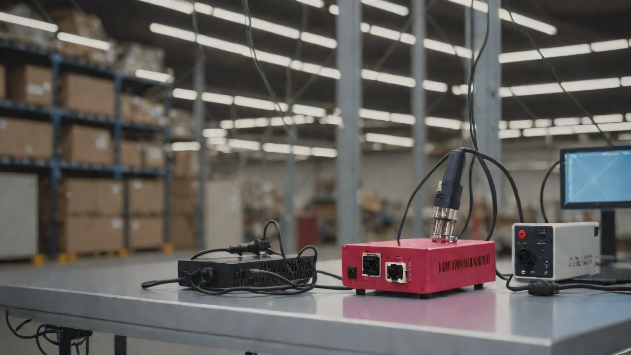
Raspberry Pi will serve as the brain of the system, providing a cost-effective and easy-to-use platform for developing indoor navigation solutions. The Raspberry Pi board is equipped with a quad-core processor, 4GB of RAM, and various interfaces such as USB, HDMI, and Ethernet. These features make it an ideal choice for developing complex applications such as indoor navigation.
The Raspberry Pi will be responsible for processing data from the LiDAR sensor, mapping the environment, and providing navigation instructions to users. The system will also integrate with other sensors such as GPS, accelerometers, and gyroscopes to provide accurate location tracking and orientation.
1.2 Industrial LiDAR Integration
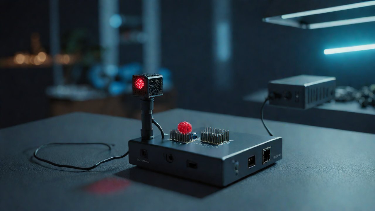
Industrial LiDAR (Light Detection and Ranging) is a high-precision sensor that uses laser light to measure distances and create detailed maps of the environment. The LiDAR sensor will be responsible for scanning the environment, detecting obstacles, and providing accurate location data to the Raspberry Pi.
The Industrial LiDAR sensor used in this solution will have the following specifications:
| Specification | Value |
|---|---|
| Wavelength | 905 nm |
| Pulse repetition frequency | 100 kHz |
| Measurement range | up to 200 m |
| Accuracy | ±1 cm |
1.3 AI and Machine Learning Integration
The system will integrate with AI and machine learning algorithms to improve its accuracy over time. The AI engine will analyze data from the LiDAR sensor, user behavior, and environmental changes to adapt the navigation instructions and optimize the system’s performance.
The AI engine will use various techniques such as:
- Map building: Creating detailed maps of the environment using LiDAR data.
- Path planning: Planning optimal routes for users based on their location and destination.
- Object detection: Detecting obstacles and other objects in the environment to prevent collisions.
2. Market Analysis
2.1 Market Size and Growth
The global market for indoor navigation is expected to grow significantly in the coming years, driven by the increasing demand for efficient and accurate navigation systems. According to a report by MarketsandMarkets, the global indoor navigation market is projected to reach $13.4 billion by 2025, growing at a CAGR of 23.6% during the forecast period.
| Year | Market Size (USD billions) |
|---|---|
| 2020 | 2.1 |
| 2023 | 4.8 |
| 2025 | 13.4 |
2.2 Industry Verticals
The indoor navigation market is expected to be driven by various industry verticals, including:
- Logistics and transportation: Indoor navigation systems will play a crucial role in optimizing warehouse operations, improving inventory management, and reducing errors.
- Retail: Retailers will use indoor navigation systems to enhance customer experience, improve product placement, and increase sales.
- Healthcare: Hospitals and healthcare facilities will use indoor navigation systems to improve patient flow, reduce wait times, and enhance overall care.
3. Technical Requirements
3.1 Hardware Requirements
The system will require the following hardware components:
- Raspberry Pi board: Quad-core processor, 4GB of RAM, USB, HDMI, Ethernet interfaces.
- Industrial LiDAR sensor: High-precision sensor with accuracy ±1 cm.
- GPS module: GPS module for location tracking and orientation.
- Accelerometers and gyroscopes: Sensors for detecting user movement and orientation.
3.2 Software Requirements
The system will require the following software components:
- Operating System: Linux-based operating system for Raspberry Pi board.
- AI engine: AI engine for processing LiDAR data, user behavior, and environmental changes.
- Map building algorithm: Algorithm for creating detailed maps of the environment using LiDAR data.
4. Implementation Roadmap
4.1 Phase 1: System Design (Q1-Q2 2026)
- Develop system architecture and design
- Integrate Raspberry Pi board with Industrial LiDAR sensor
- Implement AI engine for processing LiDAR data and user behavior
4.2 Phase 2: Prototype Development (Q3-Q4 2026)
- Develop prototype of the indoor navigation system
- Test and refine the system in a controlled environment
- Integrate GPS module, accelerometers, and gyroscopes
4.3 Phase 3: Deployment and Testing (Q1-Q2 2027)
- Deploy the system in real-world environments (warehouses, retail stores, hospitals)
- Test and refine the system in various scenarios
- Gather feedback from users and stakeholders
The integration of Raspberry Pi with Industrial LiDAR has the potential to revolutionize indoor navigation systems. The combination of affordability, ease of use, and high precision will enable the development of cost-effective yet robust solutions for various industries. As the market continues to grow, it is expected that the demand for efficient and accurate navigation systems will increase, driving innovation and adoption in the coming years.
IOT Cloud Platform
IOT Cloud Platform is an IoT portal established by a Chinese IoT company, focusing on technical solutions in the fields of agricultural IoT, industrial IoT, medical IoT, security IoT, military IoT, meteorological IoT, consumer IoT, automotive IoT, commercial IoT, infrastructure IoT, smart warehousing and logistics, smart home, smart city, smart healthcare, smart lighting, etc.
The IoT Cloud Platform blog is a top IoT technology stack, providing technical knowledge on IoT, robotics, artificial intelligence (generative artificial intelligence AIGC), edge computing, AR/VR, cloud computing, quantum computing, blockchain, smart surveillance cameras, drones, RFID tags, gateways, GPS, 3D printing, 4D printing, autonomous driving, etc.